Info or guide for Katterat to Rombak walk (Navvy Trail) please

Hej ,
Kan du hjälpa mig, Tack.

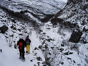
I want to walk the Katterat to Rombaksboten (Navvy Walk) in sometime next week.
There will be snow on the upper slopes but thats OK.
Is there anyone that can tell me :
1 The start point from the train station
2 Does anyone have a short description of the trail - so we know were we are walking in case its slightly covered with snow. eg - some way point descriptions down to the bridge and then to the fjord.
3 Is there a map of the trail and the walks along the fjord.

While I/we plan to arrange a boat out to Narvik, I would also like to know :
A Is there a trail that runs along the south side of the fjord past the ship wreck to the end of the road?
B If so, how long is it in time / Kms to walk.
C If so, is it easy to see/follow

Lastly.
Is there anyone who lives in Narvik, who would be willing to accompany me even as a guide.
I can pay you as a guide. If so - You must have walked the trail before.
If you have a boat contact that would be helpful.
I will be at Riksgransen and plan to walk Thur 26th Feb. I have suitable gear for the weather & a day hike. If anyone can assist with any information at all I would be very grateful.

Tack så mycket.
 
I haven't walked the trail in question but by your description I would guess that this is a summer trail. In this region, summer trails can't be used at all during wintertime (I would expect snow depths between 0.5 and 1 meter there at the moment, no visable trail or signs to follow). The tourist information in Narvik might know more (+47 76 96 56 00).
 

Lästips

Europas okända pärlor – 10 vandringar bortom turiststråken

Sugen på att packa väskan och vandra utanför Sverige? Då är den här listan för dig!

Stabil sikt för skarpa naturupplevelser – Nikons nya kikare lyfter blicken

STABILIZED S ger stadig bild i varje ögonblick. Skarp optik, låg vikt och lång batteritid gör dig redo att se mer.

Prisade prylar: här är vinnarna av Scandinavian Outdoor Award

Bland de vinnande produkterna finns bland annat en slittålig lättviktsryggsäck och en designklassiker i rostfritt stål.

Vinn skor och startplatser till Merrell Göteborg Trail Run för två!

Delta i Göteborgs stora trailfest den 6 september! Nu har du chansen att vinna både startplatser och nya MTL ADAPT från Merrell åt dig och en vän.
Hi Medon and all,
Yes thank you we have info and someone will come with us. Its great that hikers appreciate and help each other. Yes there will be snow. We are prepared with snowshoes and boat pickup (no ice in fjord). I think the "trail" along the south shore from Rombaksbotn is higher up and a summer route only. Anyways - we will have a good time. As per Fjellforum, I will post info for anyone interested when back - even though its a simple winter hike :)
Regards to all.
 
Hey 2boots,

Where're you from? It'd be nice if you could tell us your experiences from your trip, as well as recommend/not recomment it to your friends!
 
Hi Strykarräven, originally from Perth, West Australia. Down there, hiking in the south west and 4x4 bush driving in the goldfields, camping whenever I can :)
No problems to pass on what the walk was like. Will be back next week.
Regards
 
Hi Folks,
I just want to say - we are back from the north - the Katterat to Rombaksbotn hike was great.
We snowshoe'd all the way to the waters edge. A beautiful winter hike - well recommended - even if you have to arrange a boat or walk back out. (2.5hrs easy pace with a coffee stop), elk, snow, ice stunning scenery.
I will post a description & photos on my blog and here. Gotta do some work first.
Regards all.
 
Comments on Katterat to Rombak winter hike.

Hi All,
Firstly, it was a wonderful hike and one of the nicest snowshoes hikes Ive done for a long time.
Beautiful and dramatic scenery. Train from Riksgransen to Katterat (about 15min) - Hike from Katterat - Rombaksbotn 2.5hrs. From the train station, go back about 50m and find the signs that point down between the houses. Follow the signs, the trail zigzags down and then basically follows the river going steadily down. There was a fair bit of snow in the upper parts that sometimes hid the trail. The trail is marked by signposts (in summer the trail is quite clear)
but with deep snow causing trees to bend over - the path has to be "intuited"at times, however, you cant really get lost. There were trail posts and markers at significant places.
We had about 0.2 -0.3mt of powder snow over packed snow and drifts along the upper trail, deeper in places. The snowshoeing was easy going. While the trail had snow drifts obscuring in places, it was possible to follow the avenue of trees (mostly). The trail often has a drop-off on one side that makes the trail easy to follow - dont walk too close to the edge:).

The trail basically follows the river, so if you are heading down-valley between the trees, path, markers and river - its fairly easy to follow, even with the snow cover.
Once over the main bridge (dont cross the first one - it takes you back uphill to Bjornfjell).
follow the path along the river until the Rallarveien/ Naturisti sign.
The lower route was very difficult with a lot of up/down & snow/ice along the river valley. We decided on the upper Naturisti trail that follows along the edge of the big morain. Its was a flat walk in deeper snow through trees. You come out with the first view of the head of the fjord at the power lines. Work down the clearing to the path and follow it to Rombaksbotn. The bridges over streams in the delta area were covered in snow and ice and could be walked around. The path follows a small stream - keep on the south side of that until the path is obvious, an avenue through the trees - you soon come out at the festival ground - you've made it.

Make sure you organise a way out or you have to hike back up to the railway line along the same route or cross country - estimate 3.5 - 4 hours to do that. We were lucky to hook up with a RIB boat tour coming to Rombaksbotn so got a lift out. In summer there is a regular boat.
I will post a description & more images and map on my miniblog later : http://my2boots.blogspot.com/

All in all - a great walk to earn a beer at the end :)
DSC09300s.jpg
 
Sounds like you had a really nice walk. :)
With which boat did you arrange the pickup to get back to Narvik (Fjordcruise (http://www.fcn.no) or someone else?) What did it cost you?
 
Hi EHJ,
we got out with www.narvik-opplevelser.no(Narvik Opplevelser) , The guy is Kikki.
We paid discount tour, it was worth it - or a steep walk back to the rail track :)
I think a 3 hour rib tour is usually 900:- each. We still got to see the wreck, eagles and a fun ride back - cool. We took the train back from Narvik to Riks - you can see where you hiked down. Stunning train trip back. The slow boat in summer is much cheaper - this was a RIB run back, we were lucky a tour was going in :)
Regards all.
 

Få Utsidans nyhetsbrev

  • Redaktionens lästips
  • Populära trådar
  • Aktuella pristävlingar
  • Direkt i din inkorg

Lästips