Två rutter till/från Peshawar.
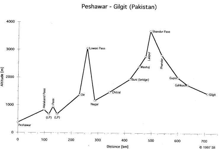
Peshawar-Gilgit (Pakistan)
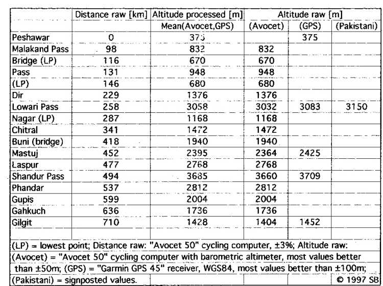 Info.
Info.
 Graph.
The Route:
Easy cycling to Dir, some rock throwing kids to watch out for. Medium steep, constant climb up to Lowari Pass. Steep (10%) downhill to Chitral valley.. Asphalt to Boni. Very bad roads on both sides of Shandur Pass. Bumpy, with lots of small and steep climbs all the way to Gilgit. In parts hard, but beautiful route. Very little traffic, friendly people and easy to find food.Peshawar-Kabul.
The Route:
It may be difficult and dangerous to get through the autonomous tribal areas on the Pakistani side. Don't want to advice anyone to do it without an armed escort, I was almost shot when trying... Easy to organize escort in Peshawar. Khyber Pass=dusty and not very spectacular. The border posts are at Torkham. A mess on the Pakistani side and you have to look hard to find the border post at all on the Afghani side. Good asphalt to Jalalabad. The road conditions gets worse the longer to the west you get. A lot of things may have happened since I was there, at that time, the road was full of big holes and long parts were under construction. NB. This is one of the routes that may have larger error marginal then the ones.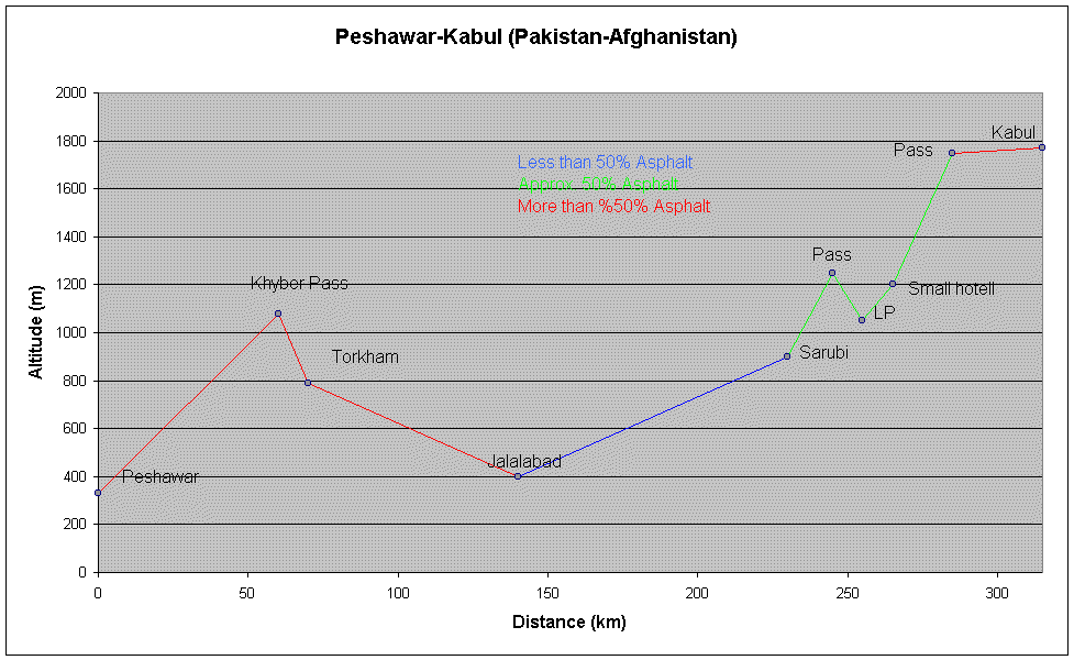 Graph.
| Comment | Distance (km) | Altitude (m) | ||
| Peshawar | 0 |
330 |
||
| Khyber Pass | 60 |
1080 |
||
| Torkham | 70 |
790 |
||
| Jalalabad | 140 |
400 |
||
| Sarubi | 230 |
900 |
||
| Pass | 245 |
1250 |
||
| LP | 255 |
1050 |
||
| Small hotel | 265 |
1200 |
||
| Pass | 285 |
1750 |
||
| Kabul | 315 |
1770 |
||


