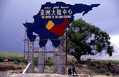
By sheer coincidence I passed this famous place.
If you think this is an interesting subject, check out; Richard
and Nicholas Crane
Journey to the Centre of the Earth.
I landed in the provincial capital of Xinjiang, Urumqi after a a flight without any interesting happenings. It was late when I landed and pitch dark. Very keen on starting my trip, I took off in the middle of the night. Had no clue where the roads towards the Tian Shan were, but reckoned if I headed south I couldn't go too wrong. Also, as long as it was uphill - fine. In the first moonlight of that night I realized I was on the right track. Slept under a bare sky feeling great - on the road again!
|
The centre of the Asian contient (I guess they
mean continent :-) ). By sheer coincidence I passed this famous place. If you think this is an interesting subject, check out; Richard
and Nicholas Crane |
 |
Already on 1800
meters I saw the first snow and the barren and dry landscape gave way for lusher
and greener surroundings. The furs got stood taller and taller in the deep
ravines and all of a sudden the air was fresh and cool. Higher up in the valley there were some weird looking clouds and I felt a burning sensation in my lungs and eyes... |
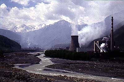 |
... The explanation for my pain in eyes and lungs. Unfortunately not the only hellcity along the route. I guess the chock is greater when you find this kind of settlements in really beautiful surroundings. |
 |
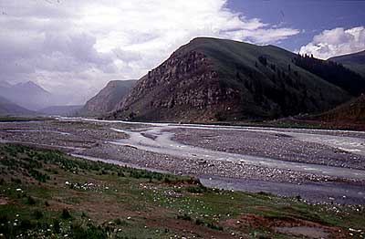
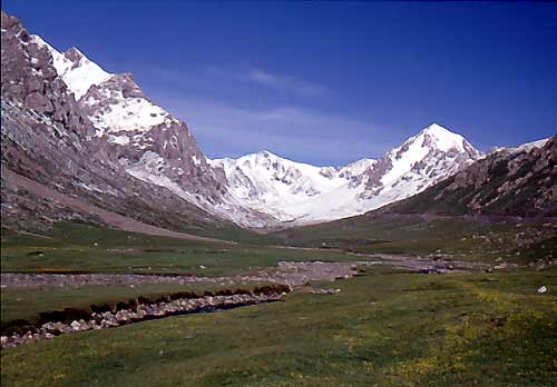
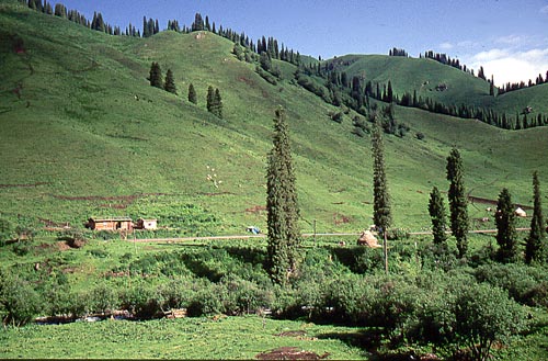
After one day of cycling, only 70 km out of Urumqi, I enjoyed crystal clear rivers, green fesh grass, spring flowers and very nice views of the highest mountains of eastern Tian Shan. |
 |
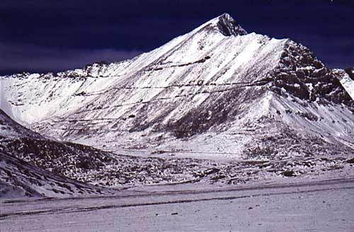
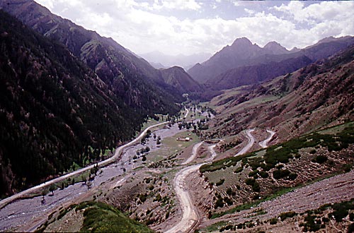
The road towards the first pass. The route from Urumqi is one of the longest climbs in the world - from 830 m to 4050 m. |
 |
After a relatively cold night I continued.
First I had difficulties to see where the road went, but I soon realized
it was even more interesting than I had thought. Switchbacks straight up
the snowy mountainside, steep and in the end with heavy snowfall. Alive
again!
|
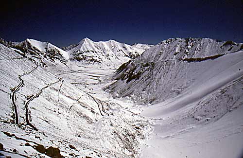 |
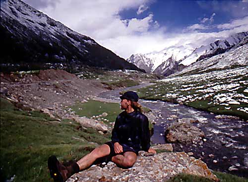
The view from the highest roadpass in eastern Tien Shan. |
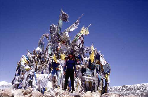 |
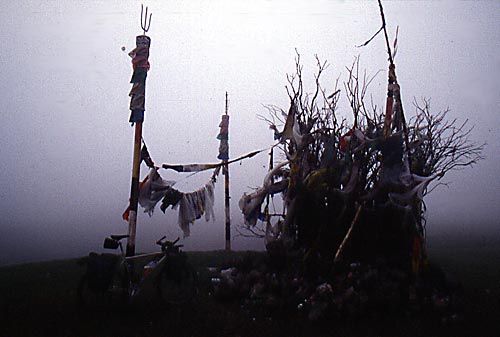
2500 meters down to Balgontai, Wanted as amny passes as possible, so I went straight up north again towards the next one. Got a bit confused when reaching the 3000 meter plus summit. How come it was decorated like a Tibetan pass, complete with prayer flags, tibetan scripts and traditional sacrifices? After all, this pass is thousands of km from the closest Tibetan settlement and i have never seen any Tibetans in this part of China. If you have any info about this, please mail me, keen on getting the answer on this one. |
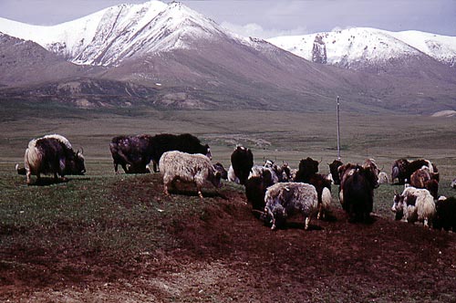 |
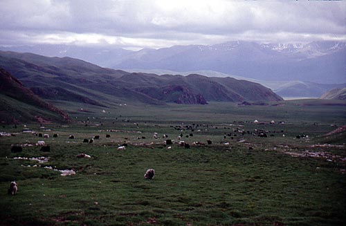
After this pass the nature changed dramatically. Huge, wide grasslands with yaks and and nomads. |
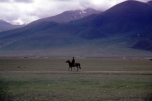 |
A lone shephard. |
 |
The climb up to the next pass was a violent experience. When approaching, I thought there was fog up there, but It turned out to be smeared out clouds. The winds seemed to blow from all directions at the same time and I had some serious difficulties to stay on the bike. Another pass with lots of Tibetan attributes. |
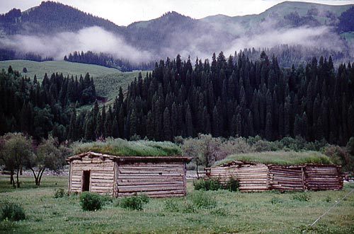 |
A very cold downhill followed. Didn't got warm until 1500 vertical meters later. Was a bit surprised to see log cabins, which was almost identical to the ones you can find in Scandinavia. |
 |
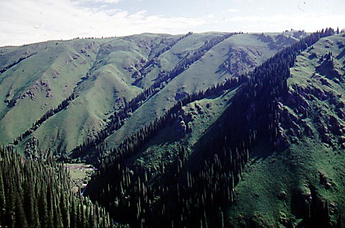
A typical view from northern Tian Shan - round, mellow green hills, filled with high Douglas furs. |
 |
The climb to pass number four. |
 |
Back on the highplateau again. Actually, I wouldn't had had to leave in the first place, but I wanted to chuck in a detour which included two more passes. Am I addicted to passes? :-) |
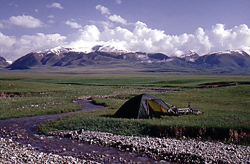 |
Took a rest on the grassy plateau. Not so
much from the cycling, as from the many violent dog attacks I
experienced along the way. Had difficulties to understand the nomad's
mentality. Their dogs attacks me - I scream for help - they don't seem
to care at all about my situation - I defend myself and strike back at
the dogs - dogs screaming in pain - still no reaction from the
nomads.
Ok, if they don't care about the cyclist under attack (still weird), but why don't they give a damn about their dogs? An enigma. |
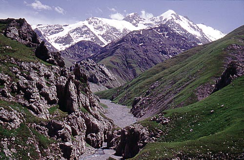 |
Left the plateau, dogs and nomads and arrived at the southern range of the Tian Shan. The peaks are generally more barren and more hostile looking here, |
 |
Down the last pass towards the lowlands. |
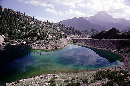 |
The Small Dragon Lake. The color of the water reminded me of the colors you find in lagoons in the Pacific. |
 |
Red rock formations where the mountains meet the desert. |
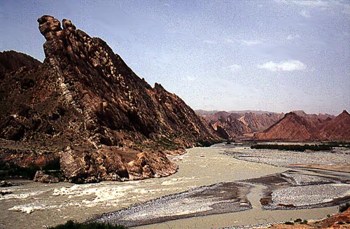 |
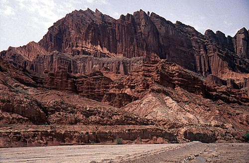
"The Devil's Gorge" close to Kuqa looked like a giant had ripped up parts of the mountains and thrown them back into the ground with a tremendous force. |
 |
It was really hot on the lowlands. Melting asphalt didn't make the journey easier. |
I got some nice and hard training in the mountains and that was one of the
reasons I had headed there in the first place. I spent 8 days in between 3000
and 4000 meters and it was an excellent start for my acclimatization for the
Muztagh Ata climb.
It had been a great warmup and start of the season, but i also found out that
some of the equipment I had gotten was crap. It's the last thing you need on a
7000m mountain.
I headed for Kashi to meet the expedition members.
Graph and info about this route To the Muztagh Ata page To main page about Xinjiang 2002