Tibet/Xizang/Bod Yol Information Page.

I've been asked many questions about travelling in this area. Here's what I can think about at the moment.
"The Tibetan Border" Maps Guidebooks  Food Hazards
Visas Route descriptions Money  Water Essentials
PSB RCC


"The Tibetan Border" 


Basically, it's a myth. Many people have asked me about this issue - how to pass it, if they need a visa for Tibet and so on. The Chinese government regard Xizang as any other of the autonomous provinces and therefore there are no borders as such. From most entry points from other Chinese provinces, you will not even notice you pass into a new province and in some other places there is a border marker or a sign showing the geographical border.

Visas


Here are some facts that may be worth to consider.
  • A visa for China is also valid for Tibet. 
  • I have been told to never state Lhasa or any other destination in Tibet on my application, in order to get the visa without hassles. If this is a myth or not, I don't know, but I've never been courageous enough to prove this matter wrong...
  • If you have a problem to get a 3 month visa (or longer), go to your embassy and ask them to write a letter of invitation/introduction/recommendation, stating that you for one or another reason need a long term visa.
    Hand it over to the Chinese and if the reason is good enough, you usually gets it. The reason...use your imagination.
  • Hong Kong is the place to go for a long term visa. 6 and 12 months visas are readily available in various travel agencies along Nathan Road in Hong Kong. Shop around, prices vary. 
  • Visa extensions in Tibet are hard to get. In the major cities in central Tibet, it's only Shigatze you've a fair change and usually only for a 7 day extension. In the outback, some of the major cities can extend, but the catch with that is, you're probably not allowed to be there in the first place. I.e. you probably have to pay a fine and risk bicycle confiscation before you can apply for an extension. As an anecdote I can mention I got 22 (!?) days extension in Bayi. My demand was 90 days and the PSB started on 3 days...Hard negotiations...
  • Kathmandu, is supposedly a place where you can't get a Chinese visa and that fact is not true whatsoever. I applied for a 90 day'er and got it without any hassles.
  • To enter Tibet from Nepal is another story. You need to book a tour and enter by air or land and you pay quite a lot for it. That is the official way. The other option is to cycle up to the border and bluff your way through. More details about this option if you mail me. 

Maps


For some parts of this part of the world, it's almost impossible to get accurate maps. On my first trip, I brought some super expensive, flashy maps from well-known publishing houses in the west. They proved to be next to useless and was at one point 350km off the mark!
I met a cyclist who handed over a tattered photocopy of a Chinese map and even though it looked very simple, without contour lines or colour, it was very accurate and was of great help.

What follows on this page is a selection of the maps I've used and some thoughts about maps and guidebooks in general.

RV-Verlag/GeoCenter CCPH China Tibet Tour Map "The Brown Bible"

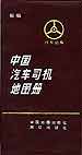
Easy to find, good for overall planning of the trip. Lots of errors and many of the smaller roads doesn't exist. A pretty good atlas for most parts of China. City and street maps for major cities. The Tibetan part is good for planning. This one can be found in English or Chinese and is accurate in most places.
Recommended.
This is what you really need for travelling in the outback! Very detailed and accurate. Pick it up in a Xinhua book shop in any major Chinese city. In Chinese.
For me, the best has been to go with the "brown bible", even if it's in Chinese and I can't decipher more than some 50 odd characters. When asking for road directions, you just point on the place you want to go to and the person you ask (hopefully) confirm you're going the right way and how far it is.
There are plenty of other alternatives, here's what I personally think of them:
  • The expensive and good looking ONC and TPC could've been the choice, but they are very seldom updated and when it comes to the roads, they are extremely outdated. For serious off road riding and trekking, the TPC could be a good alternative used together with a GPS.
  • The Russian equivalent of the above mentioned are incredibly accurate and gives huge amounts of details about the topography. Very difficult to find the updated versions and also expensive. I was lucky to find some in Bishkek, Kirgizstan and it is possibly the best maps I've ever used.
  • A Japanese cyclist gave me a guidebook from his home country and the maps in it proved to be very good. In 1997, this was the only maps I traveled with and they were excellent. Unfortunately I can't remember the name of the company who publish these maps/guidebooks. For you who have been a lot in Tibet before and therefore know what to look for, this can be an alternative. Have a look in the bookshops, compare the areas you know with the maps in the book and if it looks fine, buy it and use it for the unknown areas you're going to. Ask a Japanese traveler to translate the relevant words...
  • The nice looking, National Geographic, Nelles, Bartholomew, Geoworld etc. are next to useless except for overall planning. Don't trust any distances given and many of the smaller roads doesn't exist.
  • Lonely Planet, the ever so politically correct company have some sections of the Himalayas included in the India Atlas. Unfortunately the names are all in Tibetan and on top of that, sometimes the very old and nowadays forgotten names. According to a Tibetan guide I met in Lhasa, many of the names given on those maps are not used for a long time and he had a good laugh at the whole thing. The way I look at it, a map should be good for navigation, not for proving a political standpoint.
  • Tibetmap.com. Downloadable, very nice looking maps of many of the southern parts of Tibet. I have not tried these out in the field, but from what I can tell, from looking at them, they: A/ Looks very accurate concerning the major roads. B/ The same goes for the smaller roads, even if I think some of those are depicted in an optimistic way - probably smaller and possibly non-existing in some places. C/ Some of the bridges does not exist. D/ The names used are not always the names used by the locals living in the area, but on the other hand, that is a problem whichever map you use... 

Route Descriptions


I've been taking some notes in the areas I've cycled. Go to the main route-info page for more info.

Guidebooks


I've never felt the need to carry a guide book in Tibet.
Edit: In 2006 a very good guidebook about adventure cycling was released. Check this one out. It's good. About general planning and some about relevant Asian routes.

Money


Change as much as you think you'll need into Renmimbi before taking off for the longer routes. It can be months until you have the chance to change money again. Another consideration is, if you are caught by the PSB and have to pay an unexpected high fine, they may not accept any other currency than Renmimbi. At one occasion I claimed to be out of Renmimbi (a desperate try to avoid paying the fine...) and the only thing that lead to was a threats about confiscating gear to the equivalent worth of the fine...not a good strategy: bicycle=600Y etc.

Food


Contrary to what most people think, food is not a problem in the area. There are always shops within a couple of days cycling and if not, you can always stop at any settlement and buy some tsampa, sugar, salt and other basic foods.
  • Along most of the common routes (Friendship Highway, Golmud Highway, Kashi - Kailash - Lhasa) there are hardly any longer hauls without food, sometimes a day or two, but seldom more.
  • The Northern route (Ali/Shiquanhe - Gerze - Tsochen - Raka) have some stretches where there are 3-7 days without, depending on the distance you cover per day.
  • In the east there are plenty of food along the way, but there you have to be more careful about being noticed by the PSB.

I've only had a stomach upset once (Tashi's traveler's hangout in Lhasa) and I have not been overly careful. I would say the food in the roadside restaurants sometimes looks a bit dodgy, but are usually way much safer than for ex. on the Indian subcontinent.

Water


Water is not generally a problem either. I have very seldom came across an area where there is no water within 50km. There are some drier periods and in the beginning or end of winter you may have to melt snow. The closer to the northern parts of the plateau - The Chang Tang, the more brackish and salty lakes you'll encounter. As long as you stick to the roads, you can always flag down a truck and ask for some.

I hate water filters and therefore I don't use them. Reason...it takes time and energy to filter, filters doesn't take away all harmful contents, they are prone to clog up with sand and cold water and metal in contact with your hands is no good. On top of that, they are expensive, heavy to carry and can freeze to pieces if not handled the right way. I drink the water straight out of the streams and lakes or if the water is of very dubious quality, I use Iodine.

Hazards

Some things to consider:
  • The altitude. Be careful to acclimatize properly before heading for the first high passes.
  • The strong sun. Zinc paste on exposed parts of your body.
  • The weather. A blizzard can trap you in a bad spot if not careful.
  • Flash floods. NOT a Hollywood thing. Be careful where you put your tent.
  • Rivers. During the monsoon, there may be some very wild rivers to cross.
  • Landslides. Sounds crazy, but in the east, this is a very nasty hazard to pay attention to.
  • Truck convoys. Visibility can drop to zero, when large amounts of trucks whip up clouds of dust.
  • Dogs. Crazed from starvation the huge Tibetan Mastiffs sometimes attacks without any sense.
  • Rock throwers. Violent beggars, which sometimes tend to bombard you with rocks, unless you hand over what they demand from you. Blame the package tourists in the Land cruisers for this. 

Essentials

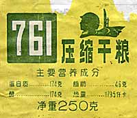
The classic for cyclists in Tibet. The 761 army biscuits. High on energy, very compact, eat it as it is or smash it with a rock and use in the porridge. The competitor - 90! A little bit sweeter, but basically the same thing as 761. The best noodle brand I've found. Good value and decent size of the portion. Mix it with powdered milk, sugar and raisins for breakfast.


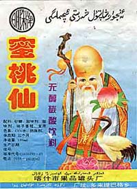
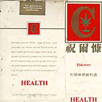
Not really a Tibetan staple, but it's an excellent refreshment in the outskirts of the area. A very common and cheap peach drink found mainly in Uighir areas. Probably the best investment for your Tibet cycling tour: 
Health Cigarettes!
Not bad for a cigarette brand costing USD 0.15.


...and finally, a quote:

"You know, when I was doing the ride around and beyond Rongbuk - Base Camp, I felt that if I have to choose between sex and the feeling of being there, I would choose the biking."

S.V.

Agreed on that!