 |
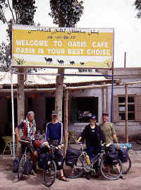
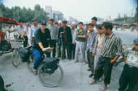
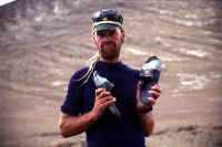
At the former Russian consulate, nowadays
Seman Hotel, raedy to take off.
A huge amount of gear for a minimalist biker?
The expedition members had left over 20 kg of high tech food and my bike
was H-E-A-V-Y when I left. |
 |
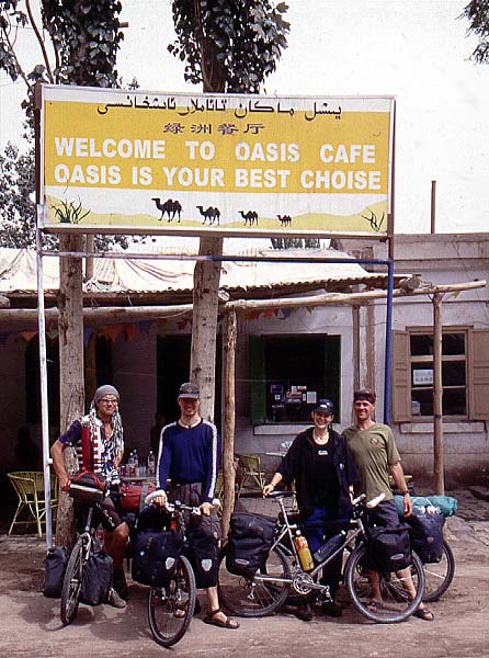
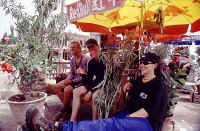
This may sound like a commercial, but go to Oasis Cafť
in Kashi! You want get disappointed. A great place to chill out, plan
and being beaten in pool.
Andi, Martin, Nadine and I, minutes before heading off. |
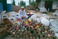 |
Crafts seller in Kashi. |
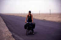 |
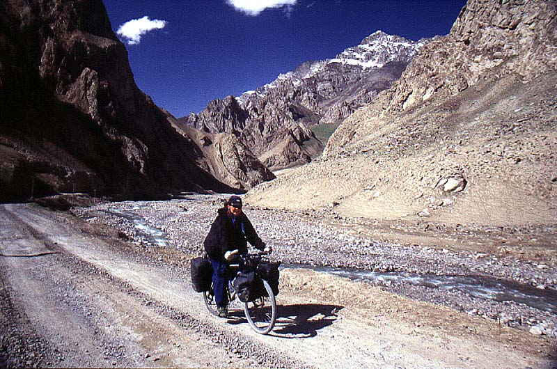
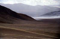
Some pretty hot cycling awaited us along the
rim of the Taklamakan. 270 km through gravel desert, oasises and some
smaller settlements.
Empty and relaxing after almost three weeks in buslting Kashi. |
 |
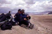
A break in a small village along the way.
We're all smiles and the picture is lying a bit. Andi didn't feel very
well even when we started the trip and he raelized his health wasn't in
order to go for a trip like this one. After three days he said goodbye
to us and returned to Kashi to recover. |
 |
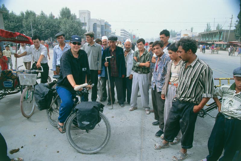
Loads of onlookers in a small town. |
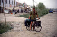 |
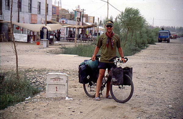
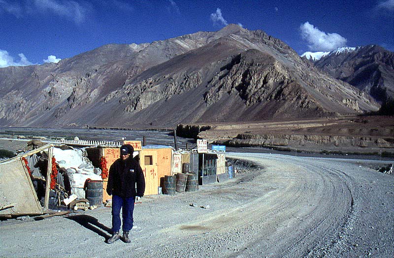
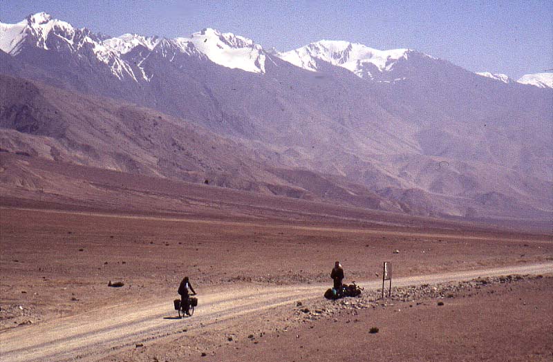
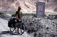
The forbidden areas starts.
A-ba and road marker # 1. A beginning of something new.
Full of anticipation! |
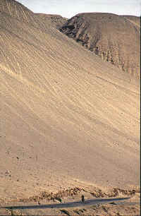 |
The sand dunes became bigger and slowly, but
surely they came in hights of smaller mountains. Here is where the
mighty desert meets the equally mighty Karakoram mountains.
The photo is taken from the first real climb.
|
 |
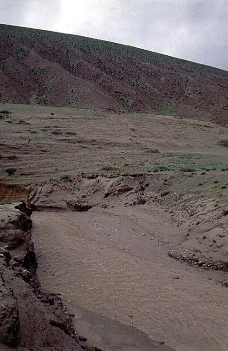
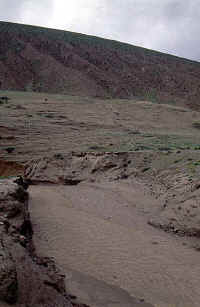
Our trip almost ended in fast and horrible
death after only four days.
Camped at a small river bed and was woken up in the middle of the night
of an amazing racket. I opened the tent and only a dm away a raging
river had materialized.
One of those flash floods you've seen in Hollywood productions. In my
wildest fantasies I couldn't imagine a river could rise 3 - 3Ĺ m in a
minut!
The litte white rock is where the tent was bfore we rapidly moved it in
the middle of the night.
|
 |
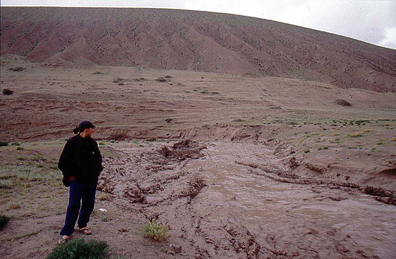
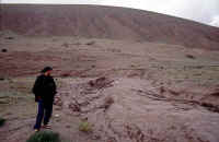
The next day the river sank to a trickle and
then once again a wall of brown water arrived with insane force.
Check the little white rock on the left side, just at the edge of the
photo, to get the proportions of it. |
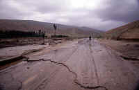 |
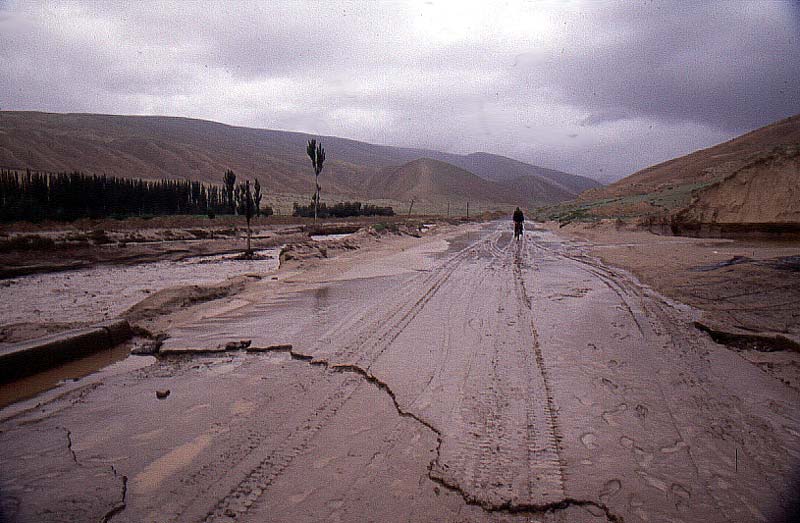
A small catastrophe for the locals. The road
washed away, the fields covered with mud and even the main street was
messed up due to the flash flooding. |
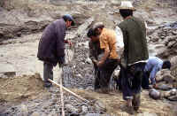 |
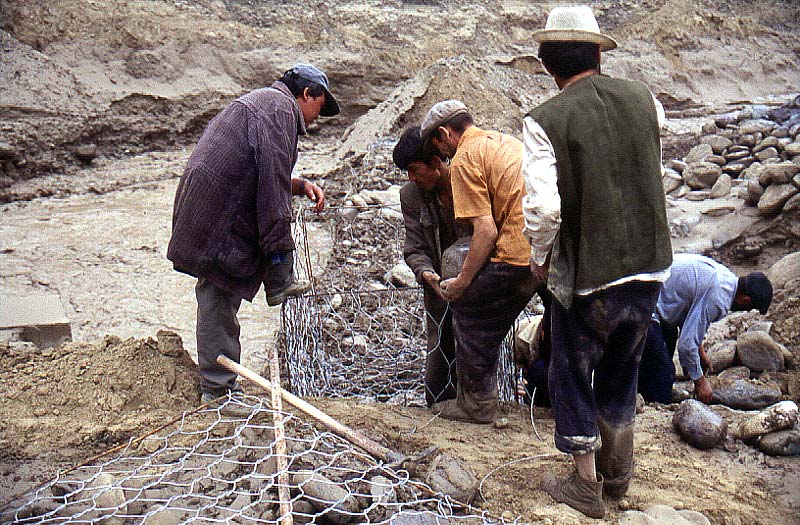
Trying to save what could be saved and
building dams to keep the water at bay a bit better next time. |
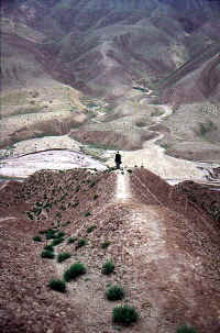 |
We realized it wasn't possible to cycle on
that day and Nadine and Martin decided to go trekking in the hills
around the river valley. |
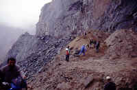 |
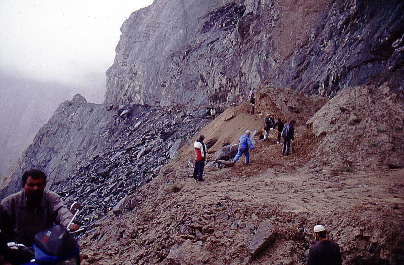
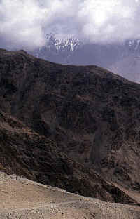
Climbed over the first pass. Loads of
landslides and rockfalls. Dangerous.
On the south side of the pass there was a massive landslide that had
taken down half the mountain side. I crossed while it was still sliding
and made it over before it was coming down thick again.
The guy with the little motor cycle wasn't as swift with his heavier
load and had to give up due to massive amounts of rocks falling cm away
from him. |
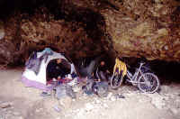 |
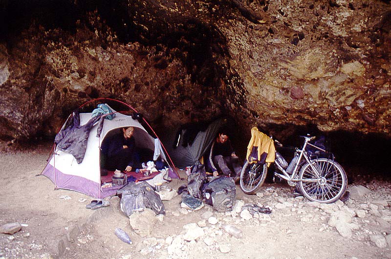
The whole area was unstable and we decided to
play it safe. Camped in a cave in order to avoid falling rocks and
massive rain. There was a small trickle of water coming down the
mountain side not far away from where the tents were pitched. Happy
about fresh water close by and a place to clean our bikes in we feel
asleep in our sanctuary.
Not. |
 |
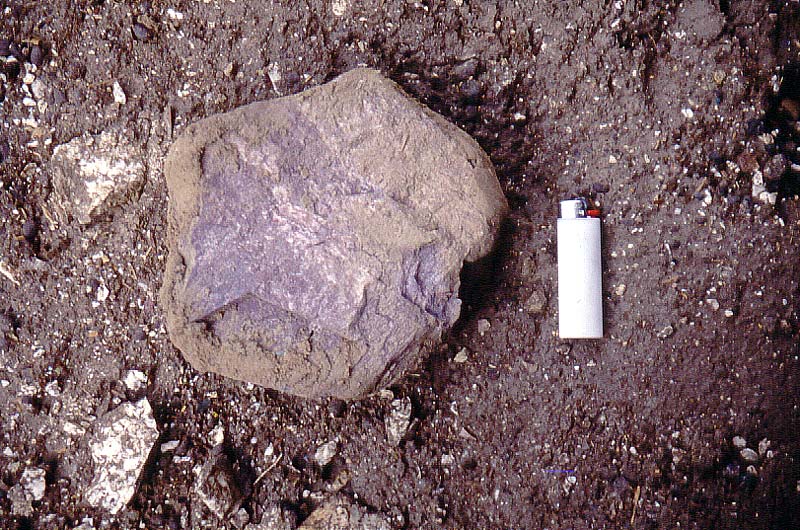
The night brought insane amounts of rain and
the little trickle of water became a gigantic waterfall. The mountain
side started to vibrate, resulting in rocks falling over the tents. The
one on the photo hit Martin's tent.
Sanctuary and safety, yeah right. |
 |
Passing the deepest river valleys and the
worst bottle necks we finally got some better weather and it was
wonderful to begin the climb towards the first high pass en route. The
5000 m high Chiragsaldi, known for it's bad weather, showed us it's best
sides and I was euphoric to be able to enjoy my birth day in one of my
favorite places on this planet. |
 |
Nadine was hit by some altitude sickness, but
it was OK after descending fast to Mazar. She is not the first person
suffering from this illness and the restaurants in Mazar are always
ready to help a person with AMS. What about sitting down and order
glucose, intravenously!
They hook you up and sitting there watching a Chinese kung fu film,
chain smoke and let the glucose filling your depots must be great. Lots
of truckies did it. |
 |
Next pass, another 5000'er, loads of switch
backs in dry surroundings.
|
 |
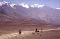
Have dreamt about trying out the back roads
close to the Indian border and it was time to fullfill those dreams. Our
plan was to head over the Kabak pass and try to get all the way to the
Indian border and the Karakoram pass, the mighty trade route pass that
once linked Brittish controlled Kashmir with the highlands. |
 |
Up we went. Fantastic views and after
battling close to 60 switch backs we reached the summit of Kabak. A dry
and sterile landscape and almost no drop met us on the other side of the
pass.
The road had been in an excellent condition and we had early realized it
was a military road. Kept a low profile and tried to hide when army
vehicles arrived. Managed to do so until 6 km after the pass. Trapped on
an open plain and a jeep came speeding at us at a too high speed.
Caught by angry military people who wouldn't listen at all to my
explanations why i just had to continue along the road we were on.
Escorted all the way back to Xinjiang Highway. Grumpy and disappointed.
In retrospect, of course it was a pretty naive plan. The whole area
was on high alert and in particular the areas close to the Indian
border. We were probably lucky to had made it without any problems as
far as we had and we didn't heard about any cyclist making it from the
east to Kashi that year.
Anyway, it was a great plan and we tried it.
Kabak pass was one of the most beautiful climbs I have ever been on so
it was definitaly worth it!
I will try it agian, next time I'm in the area, but that time I'll be
a bit more careful. |
 |
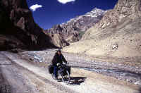
Heading for the Kabak Pass. |
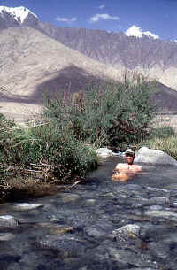 |
Returned to the foot of Kabak and had a nice
break at a warm little stream, where I took my last bath in 32 days.
|
 |
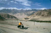
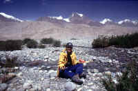
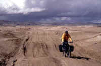
Headed further towards the plateau, here at a
little bleak pass in between Xaidulla and Dahonglitan. |
 |
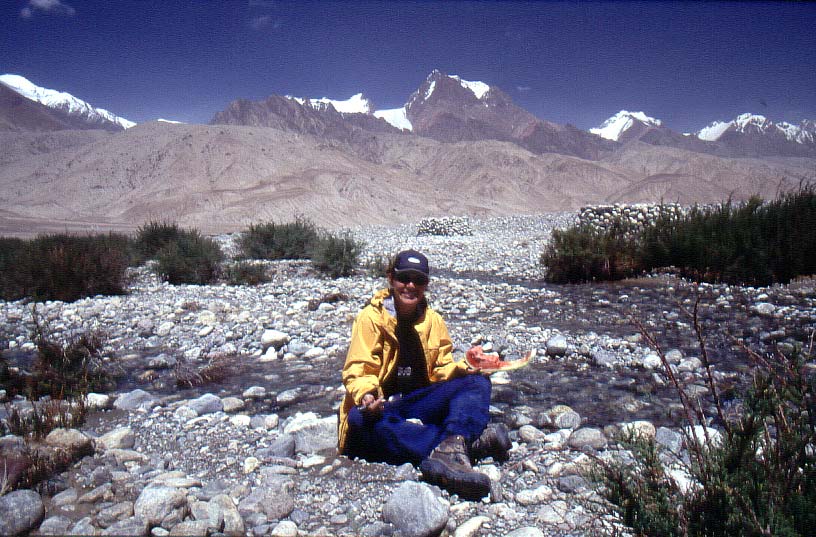
Melons, one of best snack you can get as a
cyclist.
Still a bit vary about flash floods, we actually checked the river
close to us before we sat down and relaxed.
Traumatized for life? :-) |
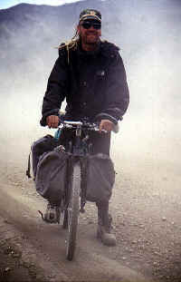 |
Some minor sandstorms made our life ever so
interesting after Dahonglitan. |
 |
I had to realize my favorite sandals were
dead, not even massive amounts of duct tape could save them any longer.
They are to be found on top of the Aksai Chin Pass overlooking the
first part of the barren plateau. |
 |
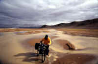
Aksai Chin is infamous for it's bad and
ever chnaging weather and we were hti by it immediately after the first
pass. Nadine, the little yellow spot is speeding down the pass in order
to avoid an extremely local hailstorm. |
 |
Nadine made it past the hail, but Martin and
I had to make it through the aftermath of it. The border of where it had
been hitting the plateau was razor sharp.
Martin walking over the streak of mud and water from the melting hail. |
 |
Happy smiles!
I found a bag in the ditch and it was full of beers and a bottle of cola.
An early morning beer in the middle of nowhere. |
 |
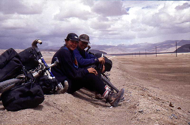
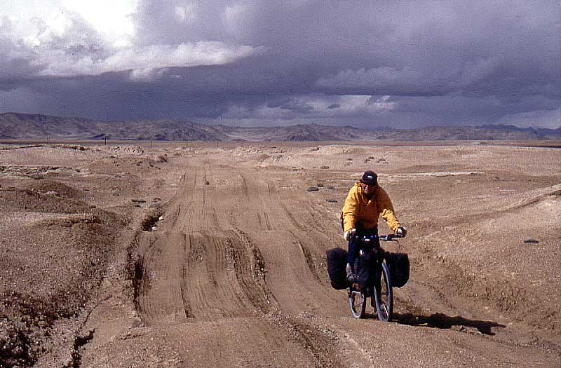
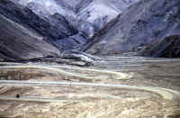
There are places where you have 20-30
different road alternatives to choose from. Some are fine, some not. |
 |
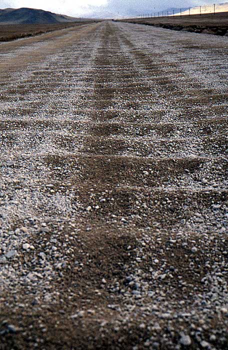
Alternatively, you can always follow the main
road, but usually it's no fun at all. |
 |
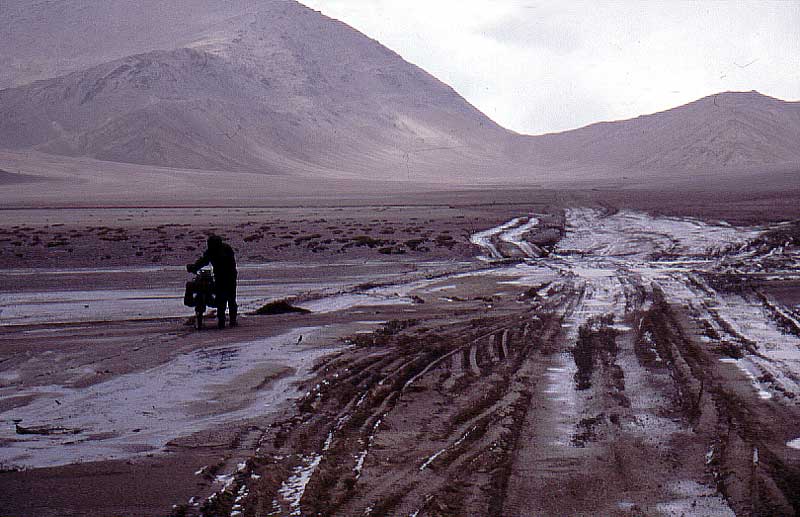
Most of the time we were very lucky with the
constant rain and thunder storms, but there were places with mud, water
and to take off the shoes and walk through the mess was cold. |
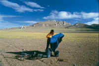 |
Packing the gear after a cold night on Aksai
Chin
|
 |
As usual, there's always someone out there
who makes your trip look easy. This Chinese photographer from Wulumuchi
had walked The Xinjiang Highway and planned to continue with that all
the way to Kangrinboqe Feng (Mt Kailas).
Wow!
|